
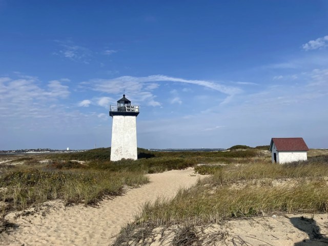
Day hikers can see two rarely visited lighthouses on a loop trail at Cape Code National Seashore.
The 5.9-mile Long Point Lighthouse Trail is not an official route but remains popular among lighthouse enthusiasts and those seeking a little adventure. This trail, however, should not be attempted with little children and by anyone with mobility issues.
To reach the trailhead, from U.S. Hwy. 6 in Provincetown, Mass., go west onto Mass. Hwy. 6A. when 6a turns northeast, head straight-right/southeast onto Province Lands Road. Park along the side of the road at Pilgrim’s First Landing Park. Head on to the jetty. The jetty goes by several names on various maps – Long Point Dike, Provincetown Causeway, West End Breakwater – but it’s the only man-made structure there heading into the water.
Jetty
When you can hike the trail during summer depends upon a couple of factors. Most important is the tide. You’ll want to walk it during low tide; long stretches of the jetty can be underwater during high tide. You’ll need about three hours to do the entire loop, so leaving 90 minutes before low tide is optimal. The other factor to consider is the calmness of the water. A sunny day with no wind is best or the rough waves will splash seawater onto the jetty, leaving the rocks wet and slippery. As the jetty top is uneven much of the way, you’ll want to ensure that the rocks are dry and that you wear hiking boots that give you good footing.
At 1.3 miles, the jetty arrives back at land on the Provincetown Spit. Follow the path right/west alongside the salt marsh. A number of animals thrive in the sea of cordgrass and saltmarsh hay, including the great blue heron, green crab, fiddler crab, fox, mud snail, northern harrier, raccoon, and ribbed mussel.
The trail turns southwest, crossing the sand spit at about 1.65 miles.
You’ll arrive at the Wood End Lighthouse at 1.75 miles. Constructed in 1872, the brick lighthouse with concrete foundation rises 39 feet. A wooden lightkeeper’s house was later built but since has been raised so that only the lighthouse and the oil house remain. In 1981, Wood End became Massachusetts’s first lighthouse powered by solar energy.
From there, continue southeast along the beach. The shoreline curls northeast as you’re traveling up the hook on Cape Cod.
Long Point Lighthouse
The trail reaches the Long Point Lighthouse at 3.4 miles. Constructed in 1875, its design is identical to the Wood End Lighthouse and replaced a light station that had been there since 1827. In 1982, it became the second lighthouse in Massachusetts to be powered by solar energy. The lighthouse marks the southwest edge of the entrance to Provincetown Harbor.
From there, walk the north side of the beach back toward the jetty. You’ll reach it at 4.6 miles (The topo map below shows the high tide waterline; if going at low tide, you’ll have beach to walk where the yellow trail crosses blue water.). Turn right/northeast onto the jetty and return to Pilgrim’s First Landing Park.
Dogs are allowed on the trail except for times of the year when the piping plover is nesting.

You must be logged in to post a comment.